New Forest Health Web-Tool Available
Oct. 11th 2018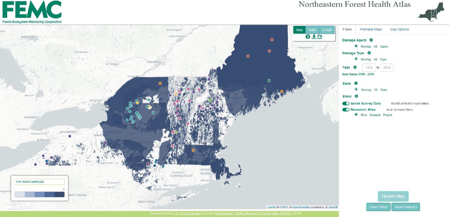
Forest disturbances have significant influences on tree vigor, species composition, and biodiversity, as well as carbon sequestration and other important ecosystem services. Recognizing the importance of monitoring forest disturbances, federal and state agencies in the United States have conducted annual aerial detection surveys (ADS) to quantify the spatial extent and severity of forest damage. Although these geospatial data have been collected for decades, until recently, they had not been synthesized across our region for multiple decades. Moreover, the Northeastern States Research Cooperative (NSRC) has supported over 300 studies to date. Although these studies address many disturbance factors, particularly in the themes of forest management, forest health, and atmospheric pollution, NSRC studies typically have focused on individual causes and consequences of change at specific locations and spatiotemporal scales. The disparate nature of these studies hinders a general understanding of disturbance dynamics and spatial patterns across the region, but it also presents an opportunity for integration across multiple disturbance agents, locations, and scales, particularly in concert with other forest health datasets.
To address the need for a regional understanding of forest disturbance, NSRC-funded scientists and other researchers developed a single interactive data exploration platform, the Northeastern Forest Health Atlas (NEFHA). It combines data from aerial detection surveys flown in those states with field-based data on tree mortality and forest disturbance. The Atlas provides an online, searchable interface for assessing decades of forest disturbance monitoring and research data in Maine, Massachusetts, New Hampshire, New York and Vermont. Using this resource, researchers developed a regional geospatial synthesis of research and monitoring data related to forest disturbance in the region. By integrating data from research projects and forest health aerial detection surveys in an interactive mapping framework across spatial and temporal scales, users are now able to investigate the extent and severity of different disturbances across the region. NEFHA is hosted by the Forest Ecosystem Monitoring Cooperative (FEMC 2017), and delivers data in maps, tables and charts. It is available online at https://www.uvm.edu/femc/forest-health-atlas.
The portal provides access to aerial detection survey and other insect survey data covering varying time ranges by state; all states have consistent coverage from 1997 to 2016. The dataset represents 222 damage-causing agents and all damage types. Major damage agents in the region over time include spruce budworm, forest tent caterpillar, gypsy moth, and balsam woolly adelgid.
A detailed exploration of the data by the project team using the Atlas investigated regional disturbance patterns spanning 17 years (2000 to 2016). The analysis indicated that approximately 11.0 million ha of forestlands (10% of the study region) have experienced at least one disturbance event over the 17-year period Insects caused the greatest amount of mapped disturbance (8.1 million ha), and a relatively small number of invasive insects (19 species) were responsible for half of this damage.
The tools and data in NEFHA provide a novel and invaluable tool for quickly finding and mapping data on forest disturbance in the northeastern US. This resource will continue to grow in volume and relevance as a changing climate, shifting land use, and new stressors continue to spur change in forests.