 ecoNEWS VT
Using Digital Soil Maps to Predict Risks of Phosphorus in Riparian Buffers
Jul. 25th 2016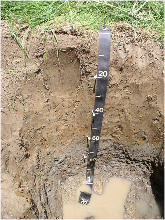
Around the world, lakes, reservoirs and other freshwater resources face the risk of eutrophication, or an excess of nutrients that can trigger algal blooms. Phosphorus (P) is the principal nutrient responsible for triggering eutrophication in freshwater systems, introduced through point and nonpoint sources. Riparian buffers, or vegetated streambanks, can reduce the amount of P entering a water body by retaining sediment and P in runoff. However, erosion of riparian zones along streams and other waterbodies can release soil-bound P, transforming buffers from a net sink to a source of P in a watershed.
Transport of P-containing soils into streams is a complex function of the type and extent of wetland vegetation, hydrology, soil composition, stream power, and other variables. Because these variables are typically unknown, management plans often account for the ability of riparian buffers to reduce P loadings, but exclude potential contributions from erosion. The goal of the present study was to determine whether soil maps could be used as a modeling tool for predicting the amount of stored P (and potential P loading) within 10 ha riparian buffer based on soil properties and location.
Researchers, Eric Young (William H. Miner Agricultural Research Institute) and Don Ross (Dept. of Plant and Soil Science, University of Vermont), recognized that existing digital soil maps, which contain routinely measured soil characteristics (e.g. pH, soil series, drainage class and organic matter content), could inform riparian restoration efforts to mitigate P. To understand if these maps would indeed be effective tools, the scientists first needed to determine the relationships between soil properties and P concentrations within and across the riparian zone.
The study took place in the Rock River watershed, Vermont. Through geospatial analyses, the researchers found a strong relationship between soil P concentrations and changes in soil properties across the buffer and at different depths within the soil. They found that P concentrations were greater in alluvial and glaciolacustrine soils (respectively composed of loose, fine grained sediment deposited by rivers and sediments deposited into lakes by glaciers), compared with soils formed in glacial till (composed of unsorted sediment mixtures deposited by glaciers).
Soil properties like organic matter content, parent material and soil drainage differences were strongly related to P concentrations. Senior author, Eric Young, says, “A surprising result was how strongly total and labile soil P concentrations within the buffer depended on soil series and organic matter content. For example, 73% of labile unreactive P variation across all locations and sampling depths was accounted for by soil organic matter content alone.”
Senior author, Eric Young, says, “A surprising result was how strongly total and labile soil P concentrations within the buffer depended on soil series and organic matter content. For example, 73% of labile unreactive P variation across all locations and sampling depths was accounted for by soil organic matter content alone.”
They note that the scale of soil survey maps does not always accurately represent actual soil variability in riparian buffers, which has practical implications for risk assessment. To account for these potential discrepancies, remapping at a lower scale when it is important to accurately understand site-specific variations in soil P concentrations was recommended. Additionally, the researchers strongly caution that robust sampling and site-specific approaches are necessary to account for localized effects of land use and soil availability before the relationships found here can be generalized to other sites.
Results indicate that soil maps could be used to characterize P concentrations and quantify risks of erosion in riparian buffers, as shown in Ishee et al. (2005). This research has important implications for states like Vermont, that are dealing with large-scale water quality crises related to nutrient loadings from nonpoint sources. The Rock River has high P loading as shown by water quality monitoring and the toxic blue-green algae bloom events that were reported in Missisquoi Bay in 2015. By quantifying the risk posed by erosion along and within a specific riparian buffer, states and other entities can more effectively target restoration and mitigation efforts to protect healthy aquatic ecosystems.