 ecoNEWS VT
Learn About Environmental Permitting and Property Planning with the Vermont Natural Resources Atlas
Mar. 23rd 2023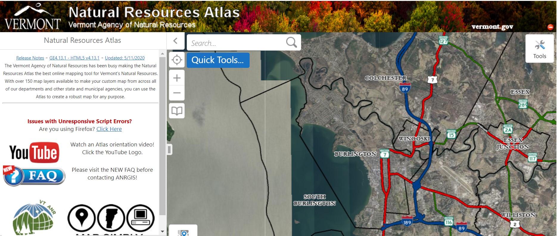
The Vermont Agency of Natural Resources (VT ANR) created and manages the Natural Resources Atlas, a collection of environmental and natural resource datasets that are translated into layers on a map of Vermont. This Atlas is available for free to the public and can be used with a Google, ArcGIS, or Facebook account.
More than 150 map layers are available to customize the map to your needs. Layers can be added to your map simply by clicking the checkbox next to the layer name. The layers range from drinking water and groundwater protection to brownfield sites to permitting status. Some of these layers must be updated manually by the VT ANR team as they collect new data, but others are connected directly to online databases which update them in real time, so all the data is as current as possible.
The Atlas builds on the previous tool created by VT ANR, the Environmental Interest Locator. With the introduction to the new ArcGIS server, VT ANR Geospatial Information Systems (GIS) specialist Erik Engstrom upgraded the old tool to include more datasets and more capabilities, such as printing PDF maps and saving projects to come back to later.
VT ANR also manages two similar mapping projects: a BioFinder map which identifies Vermont's lands and waters that support important ecosystems, natural communities, habitats, and species; as well as a Flood Ready Atlas to determine communities’ flood resilience capacity, created in response to hurricane Irene. These have similar services to the Natural Resources Atlas but are specialized. BioFinder and Flood Ready Atlas layers can be added to your Natural Resources Atlas and vice versa if a map needs various datasets.
“The Atlas is a great reference tool to inform the public about what goes into ANR permitting,” shares Erik Engstrom. “If everyone were to use it before they start a project, they would be able to see if there’s deer wintering habitat, endangered or threatened species, floodplains, etc. on their property prior to the permitting process.”
Specialty maps can be selected which utilize specific layers based on the kind of information you’re looking for. This makes it easier than having to sift through the many layers on the main map if you already know what you’re looking for.
First published in December of 2012, the Natural Resources Atlas has been used to create maps for projects across the state, namely by real estate professionals and homeowners, engineers, and consultants. In the past year, almost 40,000 users have created maps in the Atlas.
Lake Champlain Sea Grant’s Associate Director, Kris Stepenuck, created a user's manual for the Vermont Natural Resources Atlas which gives step-by-step instructions for how to use it, including screenshots of sample maps. Lake Champlain Sea Grant uses this guide in their Web-based Mapping for Real Estate Professionals workshop. This continuing education workshop, first created in 2014, has been offered ten times, teaching over 200 participants how to use the Atlas.
“The workshop benefits real estate professionals who have never used the Atlas before as well as those who use it regularly but want to know more,” according to Linda Patterson, Lake Champlain Sea Grant Land Use Planning and Water Quality Educator. “Workshop instructors give live demonstrations on how to access the Atlas, how to gather specific data and how to create and print maps for potential homebuyers. Participants get a chance to practice with the Atlas in class. The how-to guide is a fantastic resource for continuing to use the Atlas after the workshop.”
Real estate professionals can log onto the Atlas and learn about construction and alteration regulations, potential flood risks, septic requirements, shoreline protection, and local resources before touring a property with a client. This way, the real estate professional comes prepared for questions about the property and can provide necessary information to the potential home buyer. In fact, many home listings now include screenshots of the property obtained from the Atlas.
“After taking this training, I now feel like I can be more proficient with the ANR Atlas as a whole,” shares one of the workshop participants. “I will definitely be printing well reports for listings and floodplain maps for buyers who are pursuing properties in questionable areas.”
The Atlas also contains specialty maps that can be selected based on the kind of information you’re looking for. These include floodplain management, wetlands, and almost 30 other options. This makes it easier than having to sift through the many layers on the main map if you already know what you’re looking for.
In the more than ten years since the inception of the Atlas, technology has advanced considerably. Engstrom cautions not to get too reliant on the Natural Resources Atlas as it stands right now.
“There will likely be an Atlas 2.0 coming in the near future,” Engstrom explains. “If you think about it, there have been 24 updates to the iPhone in the amount of time the Atlas has been online.”
As technology advances, these changes are inevitable, but Engstrom suggests the map itself isn’t as important as making people aware of environmental interests to look out for in specific locations. Ideally, the Atlas could someday evolve into a tool in which people can submit a location of interest and VT ANR can guide them through the permitting process based on these datasets.